
Glen Lake near Glen Arbor
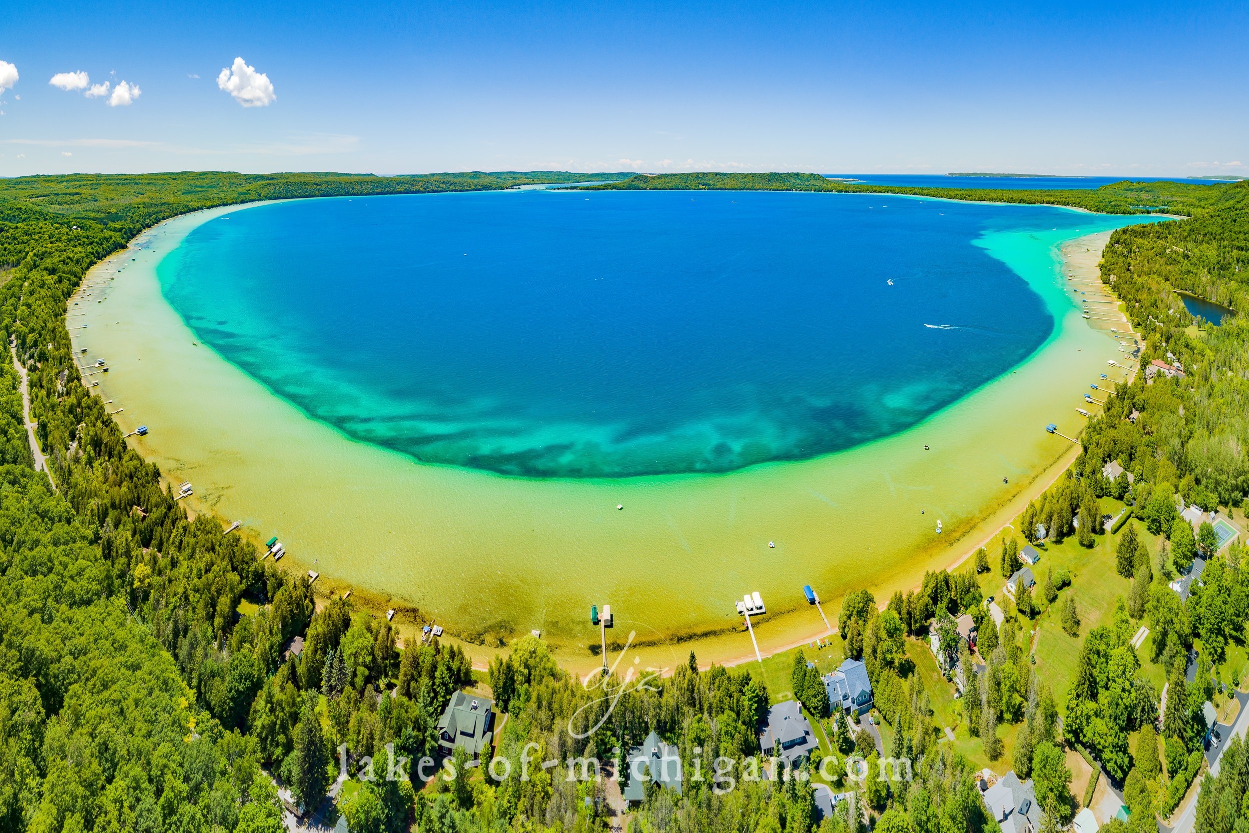
Aerial Photo of Big Glen Lake from the East
Glen Lake is divided into two sections, known as “Little Glen Lake” and “Big Glen Lake.” This is one of my favorite spots in Michigan! In this region of the northwestern lower peninsula you can kayak the open waters of Big Glen Lake or travel down the Crystal River, which connects Glen Lake to Lake Michigan. The town of Glen Arbor is situated between Glen Lake and Sleeping Bear Bay, and miles of the sandy shores of this region are part of the Sleeping Bear Dunes National Park. The famously beautiful M22 acts as the divider between the two parts of Glen Lake, and allows travelers to take in views of the turquoise waters on each side. Boaters, swimmers, and kayakers populate each side of the bridge (whenever weather allows) as they enjoy the crystal clear waters and shallow sandbar areas.
The Michigan DNR public access boat launch site is located near the northeast corner of Little Glen Lake off W Day Forest Rd.
Canvas, metal, acrylic, and super high-res “epic prints” are available to purchase by clicking on an image or by visiting lakes-of-michigan.com.

Aerial photo of Little Glen Lake, with Big Glen Lake on the right and M22 passing between.

Aerial photo of Big Glen Lake from northeast of the lake looking southwest towards Little Glen Lake and Lake Michigan

Aerial photo from southwest of the Glen Lake Narrows where M22 passes between Big & Little Glen Lake

Aerial panorama from southeast of the Glen Lake Narrows M22 bridge